We have picked up 99 inches on the upper mountain so far for February after nearly 2 feet over the last 3 days, and we have more snow on the way before the end of the month!
Milder Pattern:
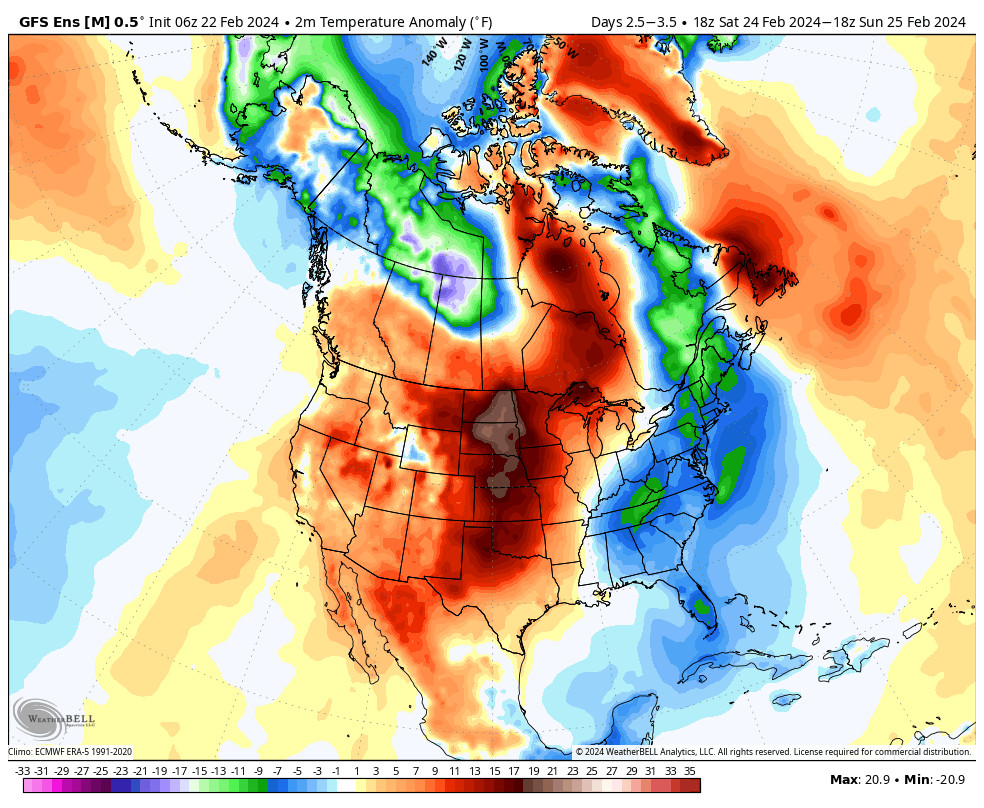
We have high-pressure building in over the West Thursday into the weekend. We will see mostly sunny skies each day through Saturday, and likely into at least the first half of Sunday. Lighter winds and above-average temperatures through the period.
High temperatures into the 40s for the lower elevations Thursday and 30s for the higher elevations, and then 40s up to 8000 ft. Friday through Sunday. We could see a few clouds start to move in later Sunday ahead of the next storm, and the winds will start to become breezy from the southwest.
Sunday Night – Monday Storm:
The latest model runs are trending a bit wetter for the Monday storm. Sunday night we start to see some moisture reach the Sierra from the cut-off low off the coast as it starts to move inland, and then that merges over the Sierra with the front moving down from the north on Monday.
With the warmer system moving into SoCal from the west, and the heaviest precipitation ahead of the cold front from the north on Monday, we won’t see the coldest air move in until Monday night behind the front. Highs in the 30s for Monday with strong winds gusting over 100 mph over the ridges and closing several ski lifts most likely.
The heaviest precipitation is expected to fall on Monday and then showers into Monday night before clearing out by Tuesday morning. Snow levels start up around 6500-7000 ft. Sunday night and fall to around 5900-6400 ft. by Monday morning, and then they could hover there near the base through Monday afternoon. Then they plummet behind the cold front Monday night.
That means we will have lower snow ratios and higher density snow to start, and then snow ratios could average around 11:1 near 8k’ through Monday, and then rise Monday night with some powdery snow to finish. We could see around 7-12 inches near the base, 10-15 inches near mid-mountain, and 13-18 inches for the upper mountain by Tuesday morning.
Tuesday – Thursday:
Weak high pressure is expected to build in for the middle of next week. That is expected to bring a few days of partly-mostly sunny skies. HIghs into the 30s on the mountains and 40s for the lower elevations near the base.
Long-Range Forecast:
We have been expecting a change in the pattern for the first week of March for a while now, and the latest model runs continue to show it. A cold trough pattern is still forecast for the West Coast for about a week from around the 2nd-8th of March.
We are hoping to combine the below-average temperatures with above-average precipitation during the period which could bring us one of the best weeks of the season for deep powder. The storms should be cold and windy and could bring quite a bit of snow if they dig slowly down the West Coast over the ocean. The first storm could arrive sometime on Friday the 2nd.
We’ll continue to watch the trends for this potentially cold and active period to start March out on the right note. The pattern could start to shift during the 2nd week of March.
BA


