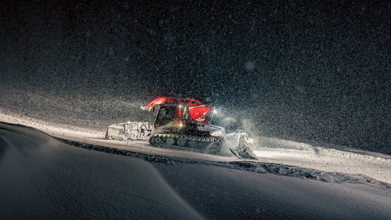
Tahoe is buried, and there are no signs of the snow slowing down. Today, (Thursday, March 9th) the first band of a two-part atmospheric river weather event moves into the Sierra region. This first Thursday-through-Saturday storm will bring more snow, but it also is expected to deliver rainfall that could lead to flooding. The powdery snow that fell recently (more than 100 inches in the first 9 days of March) is very light in density and was easily scoured by winds, which means it can be more difficult for our Ski Patrol teams to trigger planned avalanches, as they do across both mountains each time we have significant snowfall. With rain or heavy and wet snow falling on top of this lightweight snowpack, we expect that avalanche danger will increase significantly.
For this reason, you can expect to see us taking extra precautions on the mountain and putting employee and guest safety above all else, as always. This means that lift openings will be slow and could have significant impacts throughout the weekend. We also anticipate that heavy rainfall early next week might lead to flooding in our base areas. As long as it is safe to do so, we plan to stay open, but you should pay attention to the forecast and stay up to date by checking in frequently on our Mountain Ops Twitter, Weather Blog, Operations Blog, and the Palisades Tahoe App.
Photo above: Palisades Groomer Nick McMahon
Weather: What To Expect

The snow levels will be fluctuating during this storm, with rain most likely around 7,000 feet (close to the bottom of Headwall and the Alpine Lodge) but the rain could peak at 8,000 feet at times. Above 8,000 feet we will likely see all snow. By Saturday morning, we could have the following snow totals:
- 5-11 inches at the base.
- 11-32 inches at mid-mountain elevations. (2.5+ FEET!)
- 32-54+ inches on the upper mountain above 8000 feet. (4.5+ FEET!)
Here is what to expect each day:
- Friday: Winds over 100mph and heavy precipitation throughout the day.
- Saturday + Sunday: Winds closer to 50-60mph; wintry mix precipitation. Snow over 7,000 feet is likely, but it will be heavy. Sunday could see a short break in extreme conditions. Predicted snow totals for this 2-day period:
- 12-18 inches at the base. (1.5 FEET)
- 18-25 inches at mid-mountain elevations. (2 FEET)
- 23-29+ inches on the upper mountain above 8000 feet. (2+ FEET)
- Monday: Another strong storm is expected to move in.
What To Expect Tomorrow (Friday)
Winds and avalanche danger are likely to impact lifts tomorrow. We will not know exactly what to expect until we see tomorrow morning’s conditions. We will aim to provide an update by 7am. Please use our Mountain Ops Twitter and the Palisades Tahoe App for real-time information. You will want to have push notifications enabled on the app so that you can get updates immediately.
PS: We know one of you will still ask about Silverado. You can learn more about Silverado maintenance in this week’s bonus Ops Blog.
Behind The Scenes
We are truly buried in every sense of the word right now. With extremely limited breaks in the weather over the past few weeks, it has been extremely hard to dig out and get ahead again. We really, really are grateful for your patience right now. These storms have not been easy to recover from, and before we can even make a real dent, we have this huge atmospheric river moving in. Please understand that if things are slow to open, it is not for lack of effort. Take a look at how buried we are on the Palisades upper mountain:
All photos taken by Palisades Groomer Nick McMahon unless indicated otherwise.


 Photo: Nick McMahon
 Directional signage buried near Times Square. Photo: Bandit, Grooming Supervisor at Palisades
 The buried race shack on Julia’s Gold. Photo: Joe Burtness, Palisades Grooming
Our Community Is Buried, Too
Please have patience and use caution when traveling in the area. Side streets are still being plowed out, and the additional water will likely create new issues on roadways and in neighborhoods. These photos are of buried homes in Alpine Meadows to give you an idea of what it is like, taken by Kate Abraham yesterday.
 Photo: Kate Abraham
 Photo: Kate Abraham
WANT THIS BLOG TO COME TO YOUR EMAIL INBOX?
Sign up for our Mountain Operations email list, and we’ll send this blog directly to you every time we have an update. We’ll share another update soon. Sign up here.
HOW ELSE CAN I STAY UP-TO-DATE THIS SEASON?
We’ll arm you with all the information you need to plan the perfect ski day any day this winter. Bookmark these pages:
Not wanting to check the website constantly? Try these other methods:
- Follow our Mountain Operations Twitter account
- Sign up for the Palisades Tahoe Ski & Ride Report (Weather Blogs + Conditions Blogs are included here)
- Download the Palisades Tahoe App
Do you have any requests for this season’s Operations Blogs? Topics you’d like to see covered or information you think is missing? Send us an email at chatter@palisadestahoe.com with your feedback. We have received a lot of messages lately, and we are getting back to you one by one. Thanks for being patient!


