Milder Weather:
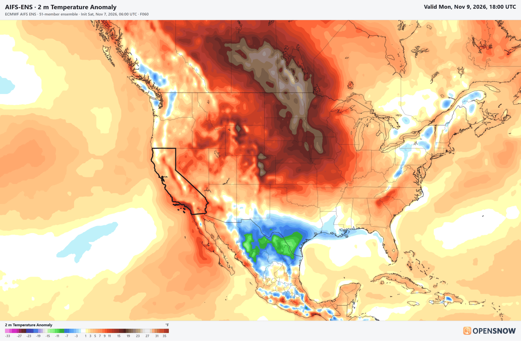
We have milder weather now for the weekend into this upcoming week, with highs near 60 degrees at the base and 50s on the mountains. Overnight lows are above freezing for most elevations, making it hard or impossible to make snow.
Pattern Change:
The pattern starts to change by Thursday, with a large eastern Pacific trough trying to push into the West Coast, opening the door to storms. But a strong high-pressure ridge over the West will have to be pushed east and eroded in order for storms to reach the Sierra through next weekend. The latest model runs are split on how much success they have, but no big storms look likely as of today.
We will continue to watch the trends all week. You will see forecasts showing light precipitation and snow possible above 7000 ft. from Thursday into the weekend. Some models are wetter than that, and some show little or no snow reaching us through the 15th…
Either way, we should cool down with highs dropping into the 40s for the lower elevations and 30s for the higher elevations. We will likely start to see gusty ridgetop winds as well as storms start to move through the region.
Long-Range Outlook:
As we get to mid-month, through the 3rd week of November, the long-range models continue to suggest that the ridge-trough pattern shifts farther east with additional storms trying to move through the West Coast, maybe with more success at pushing wetter storms into the Sierra.
The precipitation anomaly forecasts continue to show above-average precipitation from mid-month through the 3rd week of the month. The Pacific jet stream across the Pacific and the southern branch across the south look to increase in strength as we get later into November. Starting to look more El Niño-like as we get closer to winter.
Hopefully we start to see some bigger storms sooner rather than later that can lay down a nice base before Thanksgiving.
BA