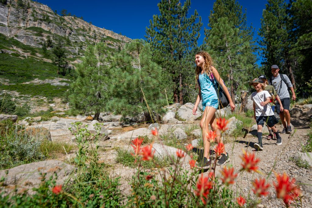
From the base of our mountain, you can step right into some of the most beautiful trails known all around Tahoe. Granite Chief and Shirley Canyon are two of our longer trails within our hiking system. However, they both offer many options to turn around, make it a loop, or take the tram down. Either one makes for a great choice if you are looking for a flexible half to full-day adventure. And with so many great overlooks and cool flora along the way, you are sure to feel satisfied no matter how far you go.

Granite Chief Trail
| Name | Distance (one way) | Elevation Gain | Difficulty | Highlights/Notes |
| Granite Chief Trail | 5.7 Miles to High Camp; 3.7 Miles to PCT Junction | 2270 Feet | Strenuous | Field of Mule’s Ear, No Snow, Views of the valley and peaks |
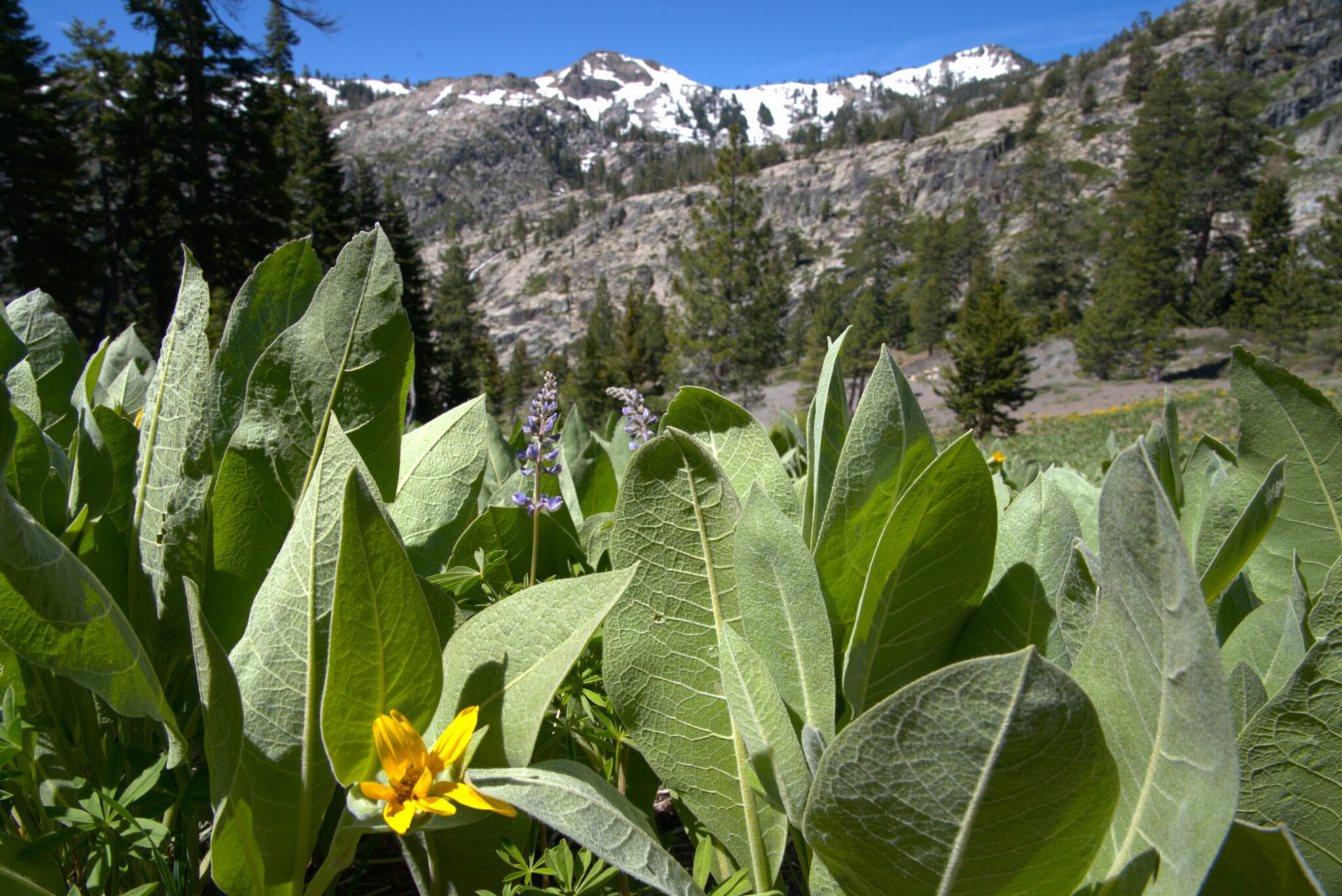
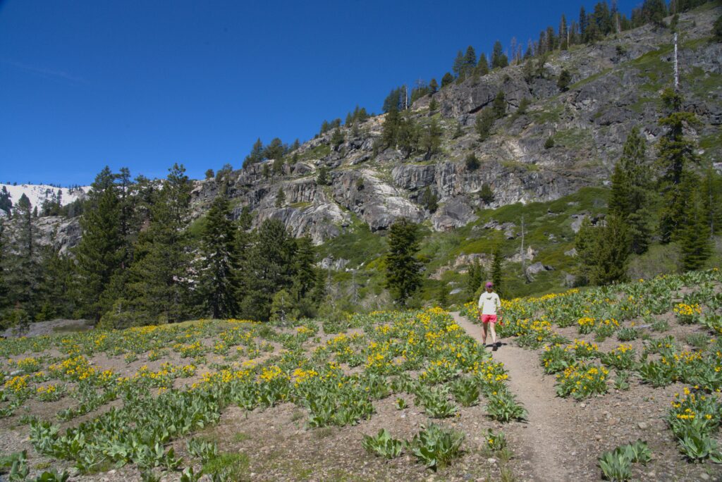
Despite having far fewer folks on the trail, the Granite Chief trail runs almost parallel to Shirley Canyon. From granite rock slabs under your feet to a valley filled with Mule’s Ear, and an epic walk against a large rock wall above, you’ll be well distracted from the moderate to strenuous hiking this trail requires.
The trail starts from the back of the Olympic Village Event Center and moves along the North side of the creek running through the canyon. After a few granite slabs and a relatively flat beginning, the trail turns right and gains some elevation. But don’t worry, the ascent is gradual as it works its way along the side of the mountain. After a journey on dirt through tall trees, the trail opens up to a beautiful valley. Mule’s Ear line both sides and a view of Granite Chief looms out to the left. After crossing the seasonal stream and passing by the wildflowers, granite steps lead you to the next section of the trail. This chunky footing may slow you down a bit from your pace on the dirt, but it will provide an opportunity to look up at the rock wall on your right. Take a moment and check out the wildflowers growing through the cracks. The chunky rocks turn to granite slabs, which eventually lead back onto dirt. And after some time back in between the trees, mild switchbacks bring you up to the junction of the PCT. This is a great time to check in with your hiking buddy, grab a snack, and decide whether you want to turn around, continue along the ridge, or head all the way to the Tram.
The ridge runs smoothly and steadily uphill along the well-marked Pacific Crest Trail. Depending on when you are out there, you may even run into some backpackers headed to Canada! The route continues to gain elevation as it traverses terrain served by the Granite Chief chairlift. Keep your eyes peeled for the sight of the lift overhead and note all of those bushes and rocks we so easily ski over each winter. With one final push, you’ll reach the ridge and climb up to the top of Emigrant Peak. Enjoy this stunning view of the whole resort, Lake Tahoe, and the canyon you just hiked through! From here, you can turn around and follow your trail back (about 4.8 miles), or you can hike down the front of Emigrant and over to High Camp (about 1 mile) and take the tram down.
Shirley Canyon
| Name | Distance (one way) | Elevation Gain | Difficulty | Highlights/Notes |
| Shirley Canyon | 3.5 Miles to High Camp; 2 Miles to Shirley Lake | 1920 Feet | Strenuous | Seasonal waterfalls, Alpine Lake, No Snow |
When looking for a hike in Tahoe, Shirley Canyon is often recommended. With easy access to the trail from the back of Olympic Valley, stunning waterfalls moving with speed and an alpine lake to top it off, there are plenty of reasons to explore this trail.
With the tram face on your left and the river on your right, the trail winds through the forest as you work your way uphill. Be sure to take your time and check out the rock pools and waterfalls along the way. The trail is mainly dirt with some areas of chunkier rock sections. You’ll continue along the river for the majority of the way up. Beside the rock pools, you can spot the base of the Silverado lift as you pass close by. The trail opens up about three-quarters up. Trail markers move from signs nailed to trees to painted dash marks along a large granite slab. This area is sunny and steep, but also somewhat short-lived. And once you make it back on dirt, you can coast your way over to Shirley Lake. The lake is a great place to have lunch, take a swim, and enjoy the views of the valley.
From here, you can turn back and follow the canyon trail you just hiked up (2 miles), or hike up the Solitude trail (1 mile) or the Shirley loop (1.5 Miles) to High Camp to take the Tram back down to the base area. The Solitude trail is a bit calmer of a way up. It climbs the ridge with a few switchbacks before leveling out towards High Camp. The Shirley Trail runs underneath the Shirley Lake Lift. It’s decently straight up and a bit more challenging. Nonetheless, you gain a new perspective on the trails you love to ride in the winter! Check in with your hiking buddies and see what is best for your group.
Be sure to check the tram schedule and time your hike accordingly if you are planning to download on the Tram. The tram is free to download and the last ride down is at 5pm. See our schedule below for more information on Summer Mountain Operations, what to pack, our Hiking Guide, and Aerial Tram hours.
All of the trails in this area have different things to offer. Whichever way you choose to explore the Granite Chief Wilderness and our home turf at Palisades is a great way to spend a summer day in Tahoe.