

Mild thru The Weekend:
We will still have high pressure stuck over the West into the weekend, which will continue the partly-mostly sunny days and mild temperatures. Highs into the 60s for the lowest elevations, 50s for mid-mountain elevations, and 40s for the highest peaks.
Monday will be a transition day as the ridge starts to depart to the east and a cold trough approaches the West Coast. Highs will cool into the 50s and 40s, with gusty ridgetop winds by afternoon.
Winter’s Return:
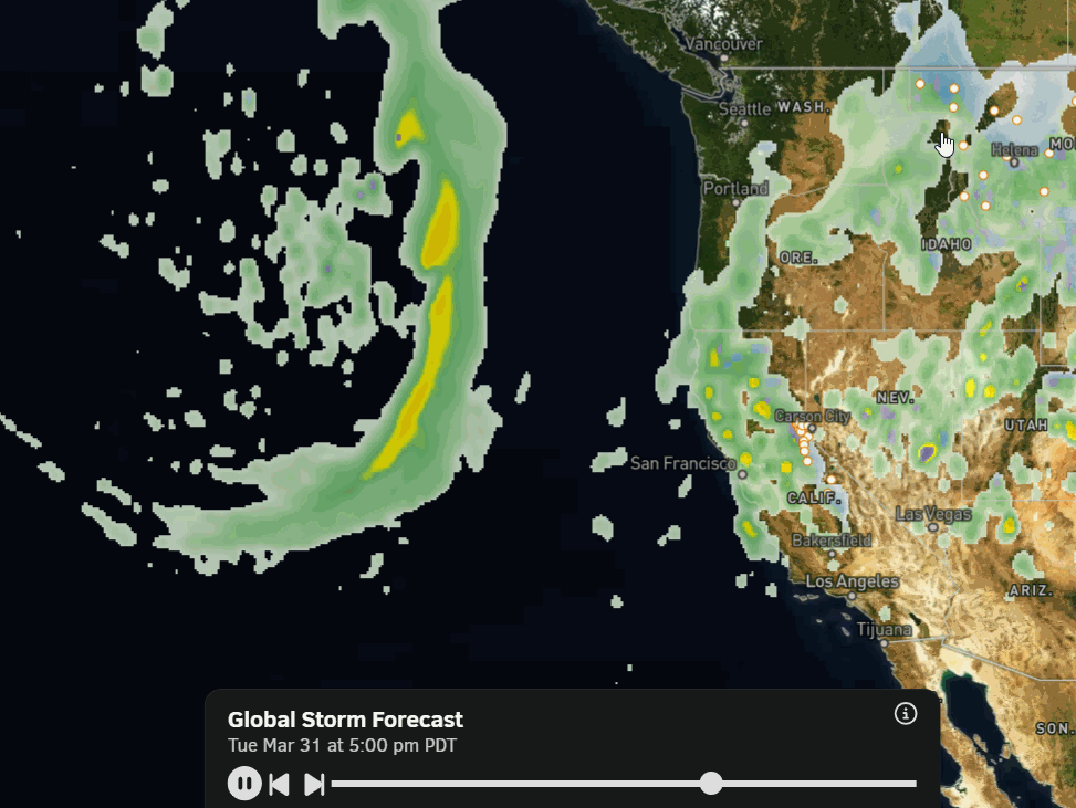
The trough pushes into the West Coast by the 31st, opening the storm door, and is forecast to be over the West Coast through the 3rd. The latest operational model runs are coming into better agreement that we will see precipitation from the first storm push into the northern Sierra on the 31st, with a wetter storm right on the heels of the first for the 1st – 3rd.
This would be the best-case scenario for cold and snow, so we are hoping that the latest forecasted storm tracks continue on this trend over the next week. The latest forecast model runs suggest that up to 2-3 inches of precipitation is possible over the 4-day period.
The temperatures are forecast to plummet with these storms. After highs in the 70s near the base last week, we may not get out of the 30s for a few days next week. Highs could drop into the 20s for the upper mountain by the middle of next week. The base will finally freeze again.
The latest model runs show that snow levels could drop to around 6500-7000 ft. on the 31st with the first storm, so rain could fall near the base. Then dropping below the base on the 1st through the 3rd. The latest OpenSnow forecast for mid-mountain is for 18-24 inches of snow by the 3rd.
It’s still way too early to buy into snowfall forecast amounts. I don’t give my own details snowfall forecasts until storms are within 5 days of arrival. The start of the possible storms is just now entering the 7-day forecast window. That is increasing confidence in a colder pattern with some snow next week, but don’t bet on totals yet.
Long-Range Outlook:
The long-range models show lower heights staying over the West beyond the 3rd into the 2nd week of April, but high pressure building in over the eastern Pacific near the West Coast.
That pattern would keep us from seeing a heat wave, but it’s spring with a strong sun, so highs will likely rebound into the 50s for the lower elevations and 40s on the mountain by the 1st weekend in April, which is seasonal for this time of year.
Weaker storms could drop down from the north with some showers in that setup. But bigger snowstorms are unlikely. It could be winter’s last gasp next week that helps to prolong the season a bit, but we will likely be back to a typical slow melt into the 2nd week of April.
BA
