

Chance of Showers thru Monday:
We have some clouds and sun on Saturday morning as a weakening system moves through the region, mainly to our north. Moisture with a chance of showers will move through the northern Sierra through Sunday, with maybe a better chance on Monday as the system departs to the east by Monday night.
Temperatures will start out the mildest on Saturday with highs in the 50s for the lower elevations and 40s for the upper mountain. Then step down a little each day, with highs in the 40s for the lower elevations by Monday and 30s for the upper mountain. Ridgetop winds gusting up to 40-50+ mph Saturday and Sunday, and then dropping on Monday.
Snow levels start around 10,000 ft. Saturday and step down around 1000 ft. every 12 hours or so. Down to 8000 ft. on Sunday and near the base Monday morning before rising again into Monday night. That could bring some snow showers to the upper mountains on Sunday and the base on Monday.
That could bring a dusting to an inch of snow to the upper mountain on Sunday into Sunday night, and a bit lower in elevation on Monday.
Tuesday Weather:
Mostly sunny for Tuesday with highs in the 40s, to near 50 degrees at the base.
Wednesday Dusting Possible:
A small trough drops south on Wednesday and catches the northern Sierra on the western edge, maybe bringing a few scattered snow showers. The latest model runs show less than a tenth of an inch of precipitation in total, so we may be lucky to see more than just a few flakes.
Temperatures cool a bit with highs in the 30s for the mountains and low 40s near the base. Ridgetop winds from the SW could gust up to 40-60+ mph at times.
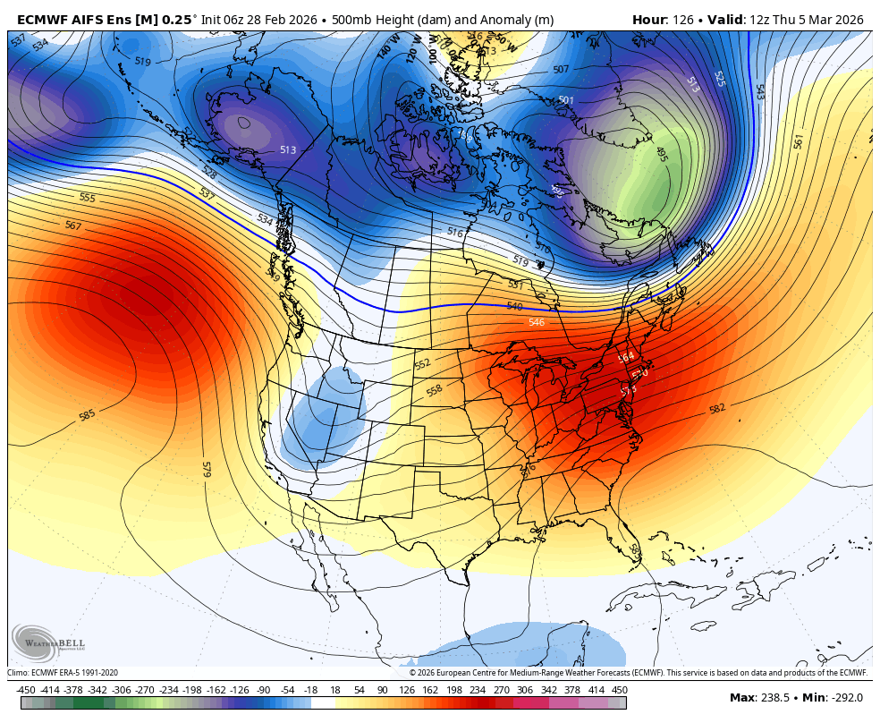
Long-Range Outlook:
By the 5th through the 2nd week of March, possibly out to mid-month, the long-range models show a high-pressure ridge anchoring just off the West Coast, blocking any wet Pacific storms from moving into the West Coast.
We are expecting mostly sunny skies again by Thursday through next weekend, with highs warming into the 50s for the lower elevations and 40s for the higher elevations.
A cold trough is forecast to drop into the West around the 9th/10th, which could bring some colder air into the West along with some snow for the Rockies. We could cool our high temperatures around 5-10 degrees, but the ridge near the coast could keep most or all of the precipitation to our east.
Looking for Snow:
Looking out beyond mid-March, the longer-range models still suggest that the ridge could back up away from the West Coast towards the end of the 3rd week into the beginning of the 4th week of March.
The teleconnection pattern forecasts seem to line up with a possible West Coast trough at some point later in the month, which could open the door to some storms. But that is 2+ weeks away, with nothing significant currently expected before then…
BA
