**5:45 PM Update on Wednesday, February 18**
New post: Storm Cycle Update: Deep Snow, Slow Starts, Speed of Safety
**11:00 AM Update on Wednesday, February 18**
Now open (lower mountain only):
- Palisades:
- SnoVentures including First Venture and Ashoka Carpet
- Palisades Kids including Boomer and Magic Carpet
- Exhibition, Far East, KT-22, Red Dog, Resort Chair
- Alpine:
- TLC Mid-station, Big Carpet, and Roundhouse
Anything is subject to change at any time.
Thank you to our ops teams and to our guests for your patience.
Please ride and ski safe, and check the Mountain Report or Ikon Pass app for the latest.
**8:50 AM Update on Wednesday, February 18**
Crews are working hard and we’re aiming to have all scheduled lifts currently on Anticipated Weather Impact (AWI) open around 11am. This is our best estimate, and we’ll continue to share updates.
Please check the Mountain Report or Ikon Pass app for the latest information.
**6:45 AM Update on Wednesday, February 18**
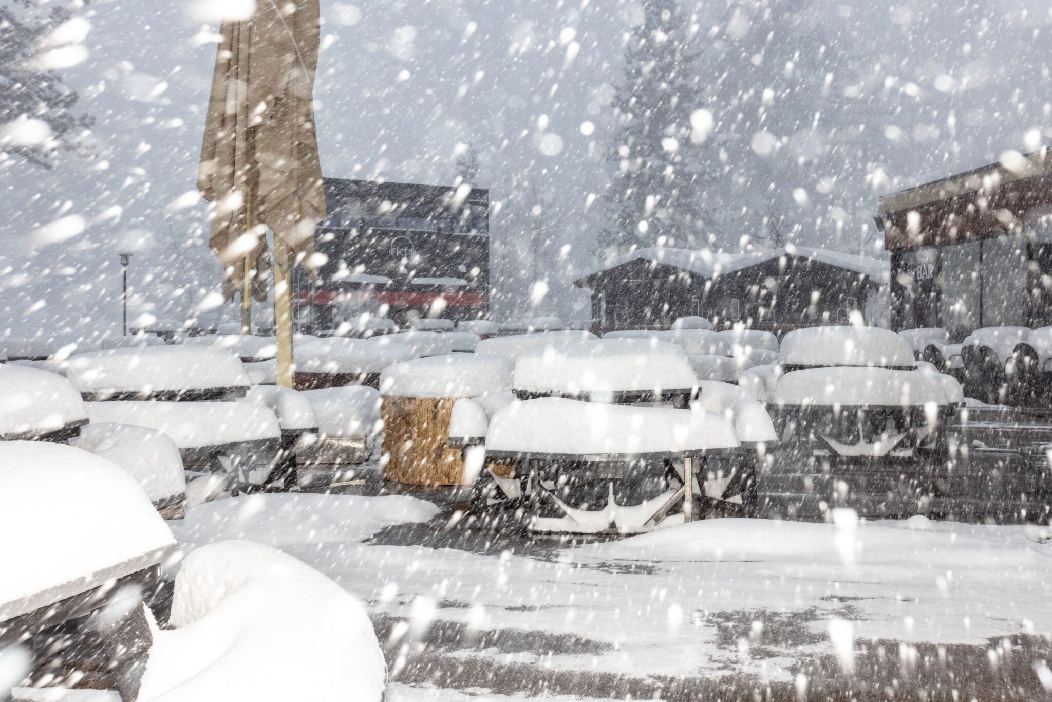
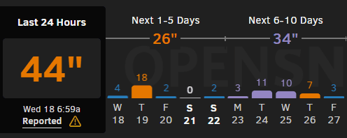
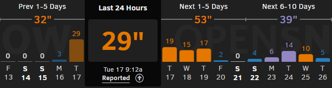
Our Mountain Operations team is reporting 15 inches of snow overnight on the upper mountain, bringing the 24 hour total to 44 inches and the storm total to 79 inches.
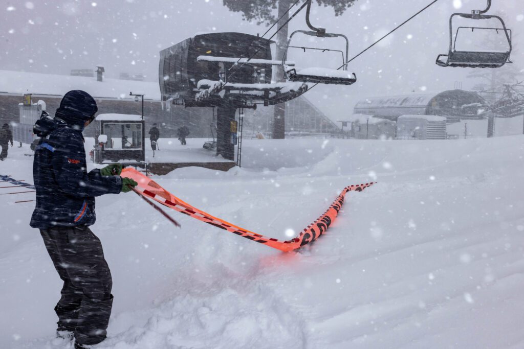
Today’s operational plan: A very slow start. Operations limited to lower-mountain lifts only today, and lift lines may be staged in different areas during snow safety work.
Nearly the entire mountain was on travel restrictions last night, meaning snowcats could not establish and maintain our access routes. We were able to stage grooming equipment at the top of many lifts; groomers will be riding the lifts to access their machines and working from the top down once they have clearance.
We still need to send ski patrol out to do snow safety work before snowcats are given clearance to travel. Upper mountain patrol teams will be starting their day on the lower mountain, effectively doubling our patrol coverage on the lower mountain.
The most up to date lift status can be found on our Mountain Report or through the Ikon Pass app.
Please practice patience today and help us move at the speed of safety.
**Original Post**
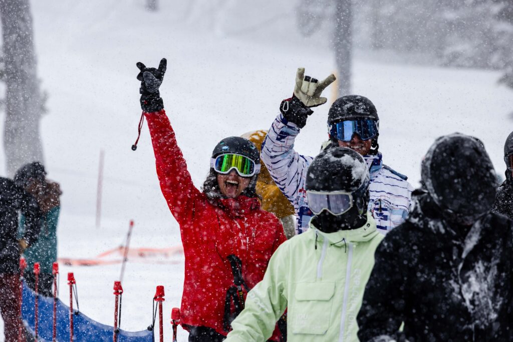
This storm has escalated well beyond early expectations. As of writing this blog, in the past 12 hours alone, approximately 30 inches of snow has fallen at 8,200 feet, with continued intense snowfall and strong winds impacting both mountains. Cold temperatures are producing exceptionally light snow (a true midwinter treat), but this also presents a complex operating scenario.
After opening this morning, increasing winds, deteriorating visibility, and continued heavy snowfall created complex conditions for both lift operations and snow safety, forcing Palisades and Alpine to close by midday for the safety of both guests and employees.
We are currently in the brunt of the storm window, with heavy snowfall and strong ridgetop winds continuing through tonight. Snow levels are dropping to near 1,000 feet, with overnight lows in the teens expected over the next several nights. If the forecast holds, we could see up to an additional 50 inches of new snow by the end of the week. This storm is intense, and that intensity brings meaningful operational challenges.
Avalanche danger remains considerable as new snow continues to load onto an existing surface that is not strongly bonded, requiring extensive and ongoing mitigation work across both mountains. At this time, significant on-mountain travel restrictions are in place across the resort. Our patrol, lift operations, grooming, and mountain operations teams are working continuously to manage conditions and prepare terrain as weather allows. The primary challenge we are facing right now is access. Very few snowcats will be able to run tonight meaning we are limited in maintaining or restoring the primary mountain access routes. At this time, patrol has very limited ability to reach terrain and conduct snow safety work.
Deep Snow Safety Reminders:
Avalanche danger is expected to remain considerable through the week, with active mitigation work continuing across both mountains. Terrain may close at any time for control work, and rope lines and boundary markers must be respected. Our teams are moving at the speed of safety, and we ask guests to adopt that same mindset while navigating changing conditions. Expect a highly dynamic operating environment as mitigation work and weather impacts continue.
- Closed terrain is closed. Period. Give crews the space they need to complete control work, slope maintenance, and set up.
- Ride with a partner and maintain visual contact from top to bottom.
- Avoid the base of trees when skiing & riding in deep snow.
- If you are going to fall, attempt to do so feet first.
- The more snow, the higher the risk.
- We recommend you carry, and know how to use, rescue equipment, including a beacon (transceiver), shovel, probe, and whistle.
Plans for Tomorrow:
Tomorrow’s forecast currently shows lower wind speeds and reduced snowfall intensity compared to today. While conditions are expected to remain dynamic, these changes may provide improved opportunities for mountain operations teams to rebuild access routes, continue snow safety work, and make strides in terms of lift operations ahead of the weekend.
Palisades Outlook
- A “KT East” scenario is planned again for tomorrow, with operations focused on lower mountain lifts such as KT-22, Red Dog, Resort Chair, Far East, SnoVentures, Olympic Lady, and Exhibition.
- Delayed and phased openings are likely.
- Crews will continue working toward upper mountain access, but what that ultimately looks like will depend on overnight weather, morning visibility, wind speeds, and mitigation progress. There is no expectation of opening upper mountain until Thursday at the earliest.
Alpine Outlook
- Operations will be concentrated on TLC, Subway, Meadow, and the carpets.
- Roundhouse expected to open, but with a potentially significant delay.
- Alpine Meadows Road control work is scheduled this afternoon, with additional ridgeline mitigation planned as conditions allow.
- Lift and terrain openings will remain dependent on real-time weather assessments and control progress.
Operations may evolve throughout the day as conditions change. Even after lifts open, temporary holds and terrain closures remain possible.
Looking Toward the Weekend
While this storm cycle may drive operational impacts midweek, it is also delivering exactly what we were all hoping for. Proactive snow management, lift preparation, and road control is what allows us to expand terrain as weather stabilizes. As winds ease and snowfall intensity decreases, the second half of the week is trending toward standout deep winter conditions heading into the weekend.
For guests planning ahead, Friday through Sunday currently represents a break between storms for improved access and fresh conditions.
Parking reservations are required prior to 1pm on Saturday, February 21 and Sunday, February 22. Make your parking reservations now or explore alternative transportation options. Limited lodging availability remains for this weekend in The Village at Palisades Tahoe. Winter has returned and we’re celebrating by offering up to 20% off all slopeside lodging stays. Book now and one underground parking spot is included with all reservations.
We appreciate your patience as our teams continue working through this extended storm cycle. Safety remains our top priority, and operations may change quickly based on real-time weather and snowpack conditions. Please continue to check the Mountain Report, Ikon Pass app, and Operations Updates before heading to the mountain for the most current information.