

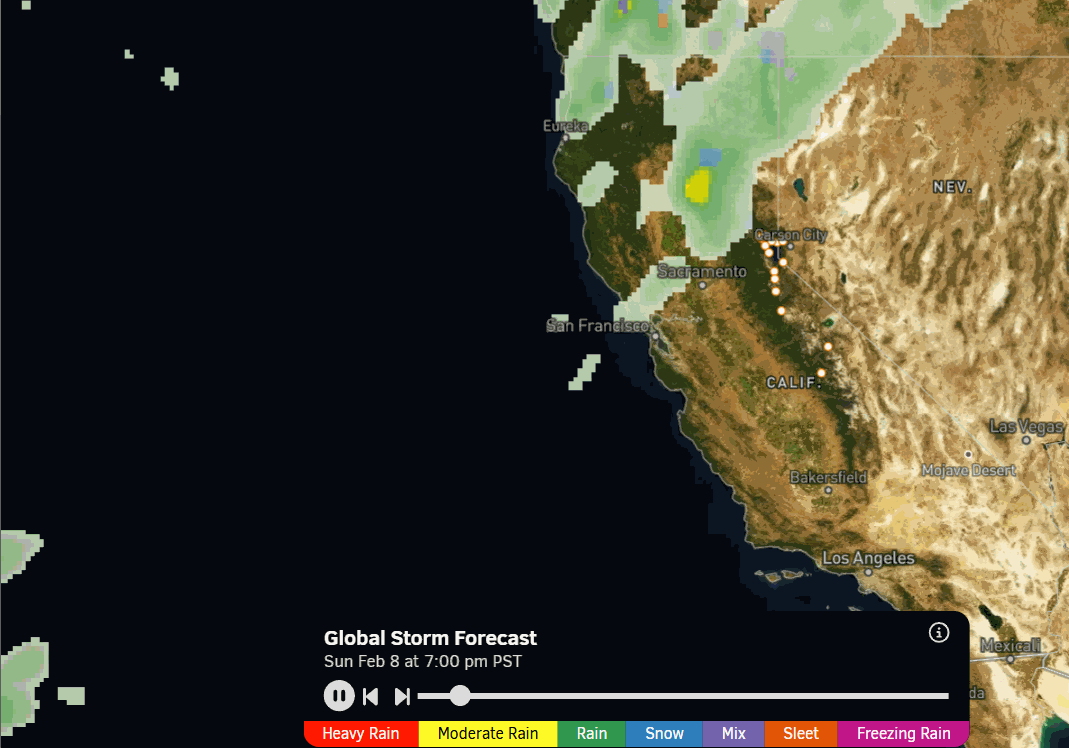
Sunday Weather:
At least Sunday is an easy forecast. The last day in the mild and dry pattern. Mostly sunny with highs in the 40s to near 50 degrees at the base. Increasing SW winds in the afternoon, with ridgetop gusts up to 50-60+ mph by the end of the day.
Monday – Tuesday Forecast Fumble:
There is not really a change for the daytime hours on Monday as the front sagging south from the north washes out over the northern Sierra with little if any precipitation expected. Mostly some clouds and cooler temperatures in the 30s on the upper mountain and 40s near the base.
The forecast for Monday night into Tuesday was for moisture to increase along the stalled front over the northern Sierra. The majority of the models now show that starting just to the south of the Tahoe basin Monday night, but then lifting north of the Tahoe Basin into Tuesday. So light precipitation that diminishes instead of increasing into Tuesday. Grrr…
A few model runs still keep the front stalled farther south, but the trend is your friend when forecasting, and the trend is much drier through Tuesday. Also, with the front lifting north, likely in response to the approaching low-pressure system off the coast, some warmer air will flow in on Tuesday.
Snow levels drop near 6000 ft. Monday night and then could rise back up near 7500 ft. by Tuesday afternoon. That means rain showers to snow showers and back to rain showers are possible below that. The latest model average would only bring 1-3 inches of snow to the mountain through Tuesday afternoon. We’ll take one last look at the trends Monday morning.
Tuesday Night – Wednesday Night Completion?
The good news is that the small low-pressure system developing off the coast is still forecast to move in Tuesday night into Wednesday, increasing snowfall and dropping snow levels. The trend is also in a positive direction towards snow showers lingering into Wednesday night.
The steadiest snow is forecast for Tuesday night with lighter snow Wednesday into Wednesday night before clearing out by Thursday morning. Highs in the 30s Tuesday and Wednesday, and dropping into the 20s for the upper mountain by Wednesday. We aren’t expecting strong winds with this system.
The snow levels could be up around 7000 – 7500 ft. Tuesday evening, before falling below the base by Wednesday morning. They could rise up near the base by Wednesday afternoon before dropping well below the base Wednesday night.
Obviously, with the trend drier through Tuesday, my forecast is adjusted down several inches. Based on the latest model trends and averages for this storm, we could see around 4-8 inches at the base, 5-10 inches near mid-mountain, and 7-12 inches up top by Thursday morning. We’ll continue to watch the trends closely.
Thursday – Friday Break:
We will see a break Thursday and Friday as the first trough exits, and we see brief high pressure over the region ahead of the next trough that will move in next weekend. Mostly sunny skies are likely with highs in the 30s, and maybe near 40 degrees for the lowest elevations by Friday.
Cold Storm Series Next Week:
The trends for Saturday are that it will stay dry, at least during the daytime hours, but the pattern change will be evident as we could see some clouds and gusty winds. We are expecting stronger winds with the next series of storms, which could start to affect upper mountain lifts as early as Saturday afternoon.
Highs in the 30s on Saturday with colder air moving in aloft and maybe only 20s for highs for the ridges along with the gusty winds, making it feel much colder for the first day of President’s weekend. The drive up should be easy on Friday, but the drive home on Sunday and beyond may be difficult as a series of cold storms are forecast to move through northern CA Sunday through Thursday, the 19th.
If the forecast continues to hold, which we’ve been forecasting this cold and stormy pattern for mid-February into the 3rd week for a month now, then this should be the coldest storm series so far this winter. Cold storms are great because cold and moist air flowing over mountains tends to bring more snow than forecast and not less.
Looking at our latest OpenSnow PEAKS model forecast for total precipitation during the period, it is showing up to 5 inches of total precipitation being forecast during the 5-day storm period. There could be around 3 main storms during the 5-day period, but we could see almost continuous snowfall as early as Saturday night through and lingering into Thursday, the 19th.
Highs may drop into the 20s for the lower elevations and teens for the higher elevations, with the cold air bringing higher snow ratios and powdery snow. That much moisture combined with cold air and high snow ratios would bring snow in feet instead of inches. The only caveat should be winds over the ridges, possibly affecting lifts and avalanche danger.
We are still a week away from this pattern change, and of course, the weather forecasts can change as we get closer, but this pattern, supported by the active phase 3 of the MJO convection over the Indian Ocean, has been forecast for quite a while with a decent amount of confidence, with the teleconnection support. We’ll continue to have cautious optimism as we watch the trend all week.
Long-Range Outlook:
The long-range models continue to suggest that the deep trough over the West Coast begins to lift north beyond the 19th through the last week of February. As we get closer to the end of the month, the long-range models suggest the trough lifts even farther north, with high pressure building in over the southwest and SoCal.
That would bring a trend of the storm track shifting farther north with time beyond the 19th. It’s hard to argue with that if that is what the majority of the models are showing, as we will be losing support from the active phase of the MJO as it is forecast to move into phase 4 and collapse into the circle of death beyond the 19th.
We may still catch the southern edge of storms into the weekend of the 21st. But then we could shift into a drier or completely dry pattern during the last week of February. Let’s hope that is not the case, and we start to see the forecast trend back south with the storm track. We’ll continue to watch the trends through the end of the month as well.
BA
